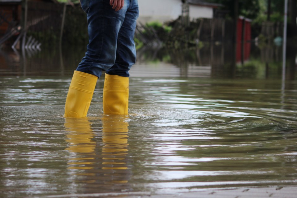
A flood watch has been issued for the City of Cambridge amid rain, warmer temperatures and melting snow.
The Grand River Conservation Authority said Sunday afternoon that river flows are increasing in the Grand River and may reach flooding thresholds for Water Street South and Hwy 24 on Sunday evening (March 16) and into the morning on Monday.
Municipal flood coordinators in the City of Cambridge have been advised to notify affected properties and monitor conditions, the GRCA said in a news release.
Meanwhile, a flood watch previously issued for the remainder of the Grand River watershed remains in effect.
The GRCA said it was also updating and issuing flood warnings for Drayton, Grand Valley, Waldemar, West Montrose, the Village of Conestogo, New Hamburg, Ayr, County of Brant, Brantford and Six Nations.
You can find more details in the following GRCA release:
Weather forecast
Temperatures in the watershed have increased to double digits above freezing over Saturday, March 15, and have remained high throughout the weekend.
A Colorado low system has moved across the watershed on Saturday and Sunday, bringing approximately 15 to 20 mm of rain along with sporadic thunderstorms.
The snowpack in the northern part of the watershed still contains a significant amount of water content. Warm temperatures combined with rain, which may be heavy at times, is resulting in snowmelt and increased runoff.
Flood Warning Message for Drayton
River flows reached Flood Warning Zone 2 in Drayton during the late evening of Saturday, March 15. While river flows have decreased to Flood Warning Zone 1, there is still a risk of increased flows due to sporadic thunderstorms and continuing snowmelt. Municipal flood coordinators in the Township of Mapleton have been advised to notify affected properties and monitor conditions. Residents are encouraged to refer to the guide on the GRCA’s website for information regarding flood warning zones.
Flood Warning Message for Grand Valley and Waldemar
River flows have exceeded levels experienced in June 2017 and continue to rise due to sporadic thunderstorms and continuing snowmelt. Municipal flood coordinators in Grand Valley and Waldemar have been advised to notify affected properties and monitor conditions.
Flood Warning Message for West Montrose
River flows have reached Flood Warning Zone 2 in West Montrose. There is still a risk of increased flows due to sporadic thunderstorms and continuing snowmelt. Municipal flood coordinators in the Township of Woolwich have been advised to notify affected properties and monitor conditions. Residents are encouraged to refer to the guide on the GRCA’s website for information regarding flood warning zones.
Flood Warning Message for Village of Conestogo
River flows have reached flooding thresholds for flooding in Village of Conestogo. Municipal flood coordinators in Township of Woolwich have been advised to notify affected properties and monitor conditions.
Flood Warning Message for New Hamburg
River flows have reached Flood Warning Zone 1 in New Hamburg, and may extend to Flood Warning Zone 2 due to sporadic thunderstorms and continuing snowmelt. Municipal flood coordinators in the Township of Wilmot have been advised to notify affected properties and monitor conditions. Residents are encouraged to refer to the guide on the GRCA’s website for information regarding flood warning zones.
Flood Warning Message for Ayr
River flows have reached Flood Warning Zone 1 in Ayr, and may extend to Flood Warning Zone 2 due to sporadic thunderstorms and continuing snowmelt. Municipal flood coordinators in the Township of North Dumfries have been advised to notify affected properties and monitor conditions. Residents are encouraged to refer to the guide on the GRCA’s website for information regarding flood warning zones.
Flood Warning Message for County of Brant
River flows have reached flooding thresholds for low lying areas and walking trail systems along the Grand River in County of Brant. Municipal flood coordinators in County of Brant have been advised to notify affected properties and monitor conditions.
Flood Warning Message for Brantford
River flows are expected to reach flooding thresholds for Gilkinson Street during the evening of Sunday, March 16 and into Monday, March 17. Municipal flood coordinators in Brantford have been advised to notify affected properties and monitor conditions.
Flood Warning Message for Six Nations
River flows are approaching flooding thresholds for 4th Line and Bateman Line, and expected to remain elevated into Monday, March 17. Municipal flood coordinators in Six Nations and Brant County have been advised to notify affected properties and monitor conditions.
Flood Watch Message for City of Cambridge
River flows are increasing in the Grand River through the City of Cambridge and may reach flooding thresholds for Water Street South and Hwy 24 the evening of Sunday, March 16 and into the morning of Monday, March 17. Municipal flood coordinators in the City of Cambridge have been advised to notify affected properties and monitor conditions.
Flood Watch Remains in effect for the remainder of the Grand River watershed
The snowpack across the watershed has been melting from recent warm temperatures, which has led to increased water levels. Higher flows in local waterways combined with runoff from this event will increase the risk of flooding in low-lying areas typically prone to flooding. In particular, municipal flood coordinators in Elora, Caledonia, Cayuga and Dunnville should be aware of these conditions and take appropriate precautions.
GRCA Reservoirs
The major reservoirs at Belwood, Conestogo, Guelph, Luther, Woolwich, Laurel, and Shade’s are at normal levels for this time of year and have storage available to help reduce the impact of downstream flooding.
Stay safe
High flows and unstable ice conditions will increase the safety risk around rivers and streams throughout the watershed. The public is encouraged to exercise extreme caution around local waterways. Parents are reminded to keep their children and pets away from watercourses. The public is reminded to stay off ice-covered waterbodies, due to unsafe conditions.
River conditions and forecasts are being monitored closely, and any additional flood messages will be issued as needed.
This message will remain in effect until 12 p.m. on Wednesday, March 19, 2025.