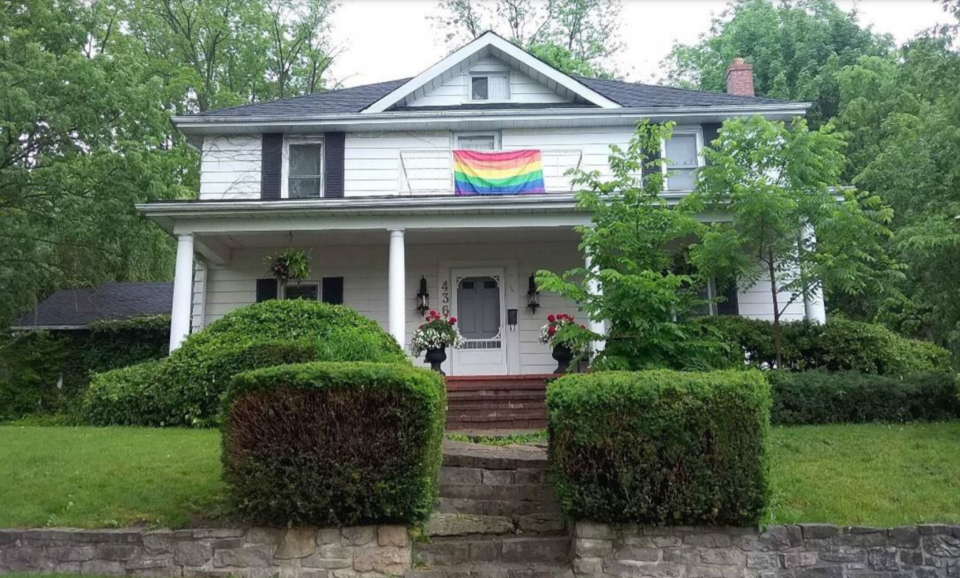
The developer behind a plan to build 11 single-detached homes on a hilly Fountain Street property has the go-ahead from the city and the region following a hearing with the Ontario Land Tribunal.
The move comes more than a year after the city and region failed to a respond to the application from Kiah Group (Vista Ridge) Inc. and Kiah Group Inc. which sought official plan and zoning bylaw amendments to create 11 lots on 436 and part of 328 Fountain Street South.
Part of the hold up had to do with heritage considerations on the property and the developer's original plans to demolish a home that has been a Preston fixture for more than a century.
That idea prompted the city to add the home to its heritage register in 2021 and request the home, and a stone retaining wall, be relocated instead.
In 2021, the city's heritage planner said the home's "contextual value" is its connection to 19th century farming in Preston. It is one of the last homes of its type to survive in that area of the city and has historical association with the Wismer family, a long standing farming family in Preston.
Other concerns expressed about the proposal included setbacks and parking.
The developer has agreed to several other changes that address those concerns.
Initially each unit had two visitor parking spaces and now the plan is for five spaces that would be on common land, shared by all units and maintained by the condominium corporation when it is formed. In addition, rather than a turnaround in the middle of project, a cul de sac has been incorporated instead.
A municipal lane runs through the property and the city has agreed in principle, subject to council approval, to close the lane and sell it to the applicant as part of the project and convey other portions to abutting landowners.
Site specific provisions include a reduced front yard and lot area for unit 1, reduced rear yard setback for unit 11, a reduced lot frontage for unit 8 as well as permission for the condominium units to have frontage on a private condominium road.
A portion of the subject lands would also be zoned to reflect the wetland area identified on site and a buffer area.


